Venice Short Line Tour
The "Venice Short Line" is so-named because it is the most direct route to Venice, of the various routes that PE used to operate to Venice. (The longer line via Hollywood was cut back to Beverly Hills in 1941. See the Hollywood Boulevard-Beverly Hills line tour for the remaining part of that route.) The Venice Short Line connects downtown Los Angeles to Venice, Ocean Park, and Santa Monica via Venice Boulevard.
We begin our tour by boarding a train at the Hill Street surface station, on the south side of the Subway Terminal building. The following photo shows the surface station with the bus deck above, circa 1944.
Our train turns onto Hill Street and proceeds south. The next photo shows a train on Hill Street at 9th, after passing the RKO Theater at 8th Street in the background.
At Venice Boulevard our train turns right towards the Pacific Ocean as shown below.
Trains proceed west on street trackage in Venice Boulevard. The next two photos show Venice line trains crossing the streetcar tracks of the Los Angeles Railway V line at Vermont Ave. The first photo looks west. The second photo, looking east, shows a 3-car train inbound.
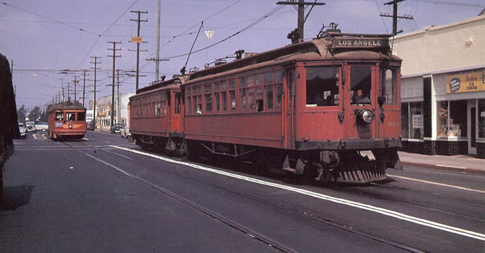
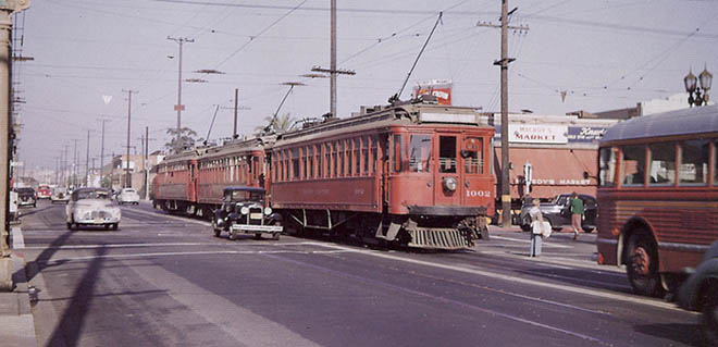
The street trackage section on Venice Boulevard continues to Arlington Avenue, where there is a short median section of private right of way with three tracks. The center track allows the Venice Short Line trains, which operate limited as far as West Boulevard, to pass Venice Boulevard-San Vicente Boulevard local cars. The next photo looks east down Venice Boulevard at Crenshaw in the '30s.
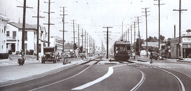
Prior to 1932, W 16th Street ended at Crenshaw. In 1932 part of the PE right of way was taken and Venice Blvd was cut through from La Brea to Crenshaw. At that time W 16th Street was renamed Venice Boulevard. As is visible in the above photo, at Crenshaw Boulevard the line swings over onto a private right of way along the north side of Venice Boulevard which continues west to Longwood Avenue. The photo of Vineyard Junction below was taken from the West Boulevard bridge.
Rapid transit plans in the '10s, '20s and '30s usually envisioned building a subway from downtown Los Angeles to this location.
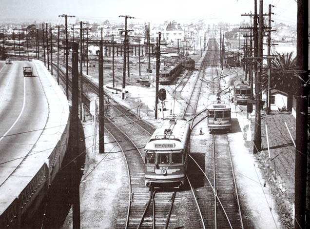
The line going straight ahead is the San Vicente Boulevard line. The Venice Short Line veers off to the left. In the next photo (by Donald Duke) an outbound train has just departed Vineyard Junction and is about to cross into the median of Venice Boulevard at Longwood Avenue.
From Longwood Avenue to Pacific Avenue in Venice the line operates on private right of way in the median of Venice Boulevard. At La Cienega Boulevard the line crosses over a grade separation (built in the late '20s and demolished in the early '60s), as shown below. The right of way was wide enough for four tracks. The 1920s Los Angeles rapid transit plan proposed to raise the Venice Blvd line onto a 4-track embankment with concrete retaining walls from Vineyard to Robertson Blvd, eliminating all grade crossings. This would have allowed high speed beach express trains a fast run into downtown Los Angeles through the proposed subway to Vineyard. Local trains running on the outer tracks would have made the local stops as far as Culver City.
In the next shot (by Ira Swett) we see the afternoon four-car Venice High School school train, about to use the crossover east of Centinela Avenue to run west to Venice High to pick up a load of students.
The next photo shows an outbound train continuing on the Venice Boulevard right of way at the Venice City Hall stop in the Oakwood neighborhood in Venice. This stop was called "Tokyo" in the early days — hence the erstwhile Oriental motif.
The next shot, taken in the '20s, looks north at "United States Island" from a point north of Rialto Street. This is a few blocks from the PE West Washington Boulevard (now Abbot Kinney Blvd) stop. "United States island" was lined with summer cottages.
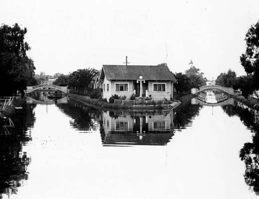
West of the West Washington Boulevard (now Abbot Kinney Blvd) grade crossing the line crosses over the Grand Canal in Venice, as shown below.
At Pacific Avenue the line curves north into street trackage from Venice Boulevard to Windward Avenue. We see an inbound train turn off the street track in the photo below.
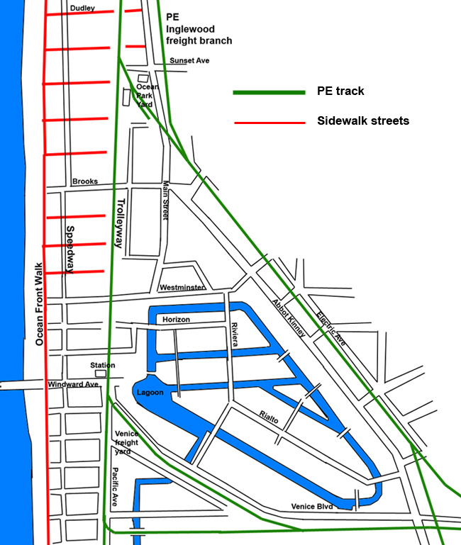
The following map provides a rough picture of the layout of Venice in the early PE era (prior to the 1920s). The green lines are the PE rights of way in Venice. The track going south of Venice Blvd in Pacific Avenue was the shuttle to Playa Del Rey. That line was abandoned in 1936. The other tracks shown were still there in the late '40s. The route along the "Trolleyway" and Venice Blvd was the PE passenger route. The other tracks were used for freight. The line along Electric Avenue was part of the PE Inglewood freight line, originally built by the Santa Fe Railway in the 1880s to Ocean Park, and still in use until the 1970s.
In the 1950s the "Trolleyway" was paved over, becoming an extension of Pacific Avenue.
The Venice lagoon and most of the canals shown were filled in by the early 1930s. A defect in Abbot Kinney's design for the canal system was the lack of an open connection with the ocean. This would have allowed the ocean tides to create currents in the canals and replenish the water. As designed, the water in the canals became stagnant. There may have been some sort of culvert linking the lagoon to the ocean but apparently this was not adequate. At it's south end, the canal system was connected to the lagoon at the mouth of Ballona Creek (prior to the channelizing of Ballona Creek in 1938). (There is a photo of the Ballona Creek lagoon in the Redondo Beach line tour.)
At Windward Avenue the line regains private right of way (called the "Trolleyway") which continues north to Pico Boulevard in Santa Monica (1.75 miles). The following postcard view from the '20s looks west down Windward Avenue from the PE station. From the collonaded area the PE line runs north, about a city block from the beach, traversing the North Beach neighborhood of Venice. The part of Venice served by the train, and the area immediately north of the city limits in Ocean Park, is a low-income working class area in which a majority of the households do not own cars.
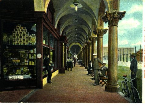
An early view of a colonaded sidewalk.
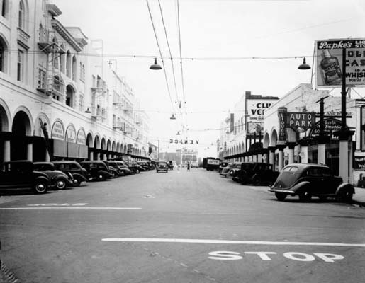
This is a shot looking east up Windward from Speedway in the'30s. The photo below looks
west at the same intersection in 1960.

The building at the left is the St Marks Hotel which no longer exists. The colonaded building to the right survives and is now called St. Mark's today.
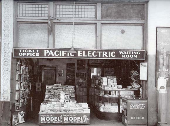
The photo below, taken circa 1946, looks north from Windward Ave as an inbound train is arriving at Venice station. The station was located on the ground floor of the Windward Hotel — a 3-story colonaded building, the building at the left. (The Windward Hotel survives as a hostel.) The sign in the middle of the right of way points to the door at left as the entry to the PE waiting room.
PE stations often had "concessions" — cafes or people who sold magazines and snacks, as we see here. This was a significant source of income for Pacific Electric.
Prior to 1925 the Venice lagoon -- center of the Venice canal system -- was immediately east of the PE station. The following is an early postcard view of the lagoon, looking east.
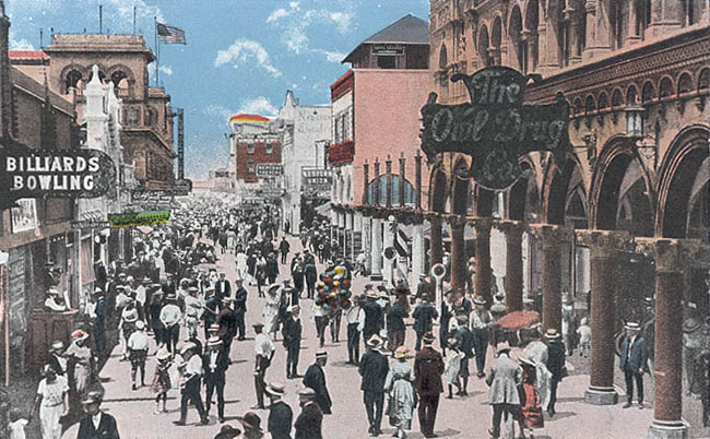
The following postcard shows Ocean Front Walk in Venice in the '20s.
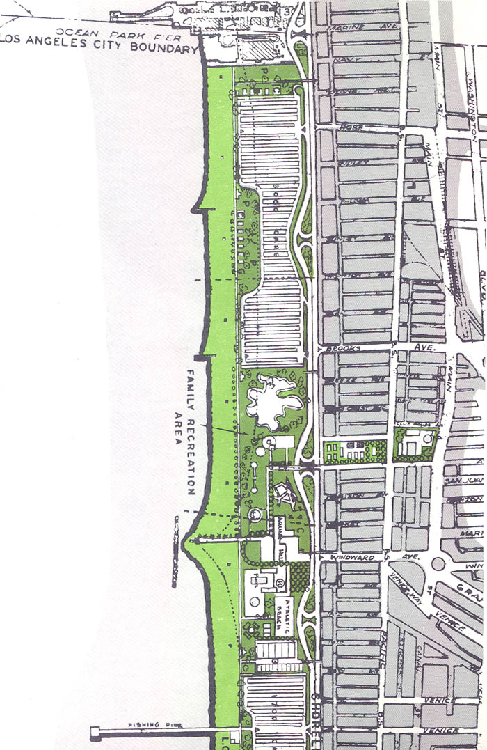
In the '50s Venice along the beach was a very poor neighborhood. The city began to work up a "redevelopment" plan for the area, as shown in the following map from 1955. You'll notice that they planned to install a dual highway with massive parking lots right on the beach.
At Thornton Avenue we encounter the Ocean Park Carhouse, which is a storage yard and maintenance facility for the Venice line. The Sunset Avenue shelter was located adjacent to the carhouse, as shown in the photo below.
A short distance further we reach Rose Avenue, shown below in a shot by Jim Stubchaer from the late 1940s. We also see one of the signals used to warn motorists of approaching trains. This right of way was paved over to extend Pacific Avenue in the '50s.
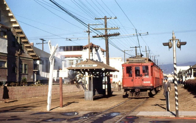
About a third of a mile further on we reach the Ocean Park station at Pier Street, shown below.
The following early postcard view looks west down Pier Street from the PE station.
The following is a 1931 postcard view of the promenade in Ocean Park.
The next photo looks north up Main Street in Ocean Park in 1926. The PE line in the Trolleyway runs from left to right along the upper part of the image. You can see the waiting shelters for the Ashland Avenue and Hill Street stops.
The densely populated neighborhood on the west side of the tracks was the poorest neighborhood in Santa Monica by the '50s and '60s. That entire neighborhood was bulldozed out of existence in the '60s. At that time the city government was controlled by a political machine based on the downtown businessmen and wealthier homeowners in the northern part of Santa Monica.
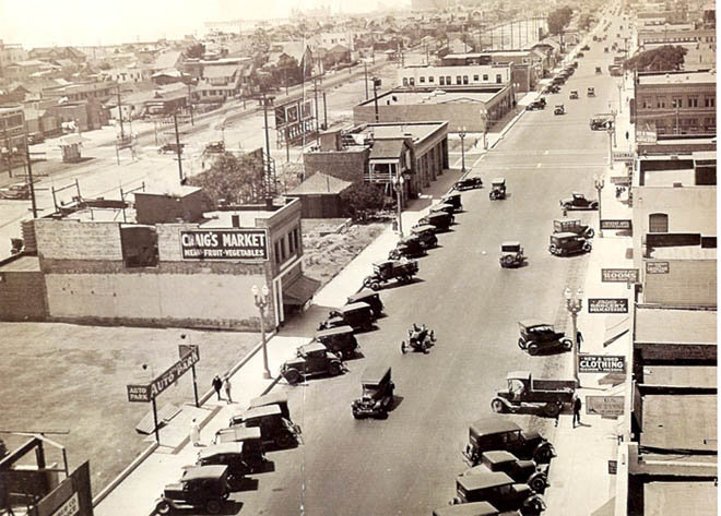
At Pico Boulevard the line enters street trackage in Ocean Avenue, and continues north a half mile to the station at Broadway, located in Palisades Park at the top of the bluff. In the postcard view below, the red-roofed building at lower left is the PE station. The large building in the center is the Deauville beach club, with the Santa Monica Pier behind it. In the far left distance the Ocean Park pier is visible.
The following is a shot of the Santa Monica station with Broadway in the background. The trains loaded along the curb.
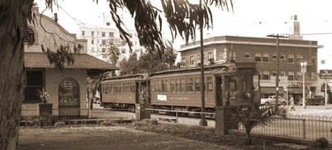
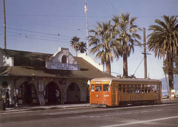
Finally, a shot of the Santa Monica station, and its Trolley Cafe, in 1950 — the last year of operation of the Santa Monica via Venice Boulevard line.
